MLinkPlanner Microwave Communications Link Planning Software
|
||
|
Featured Product Archive The inventions and products featured on these pages were chosen either for their uniqueness in the RF engineering realm, or are simply awesome (or ridiculous) enough to warrant an appearance. | 1 | 2 | 3 | 4 | 5 | 6 | 7 | 8 | 9 | 10 | 11 | 12 | 13 | 14 | 15 | 16 | 17 | 18 | 19 | 20 | 21 |
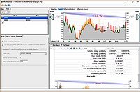
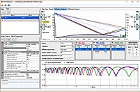
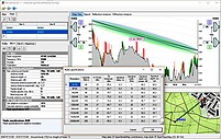
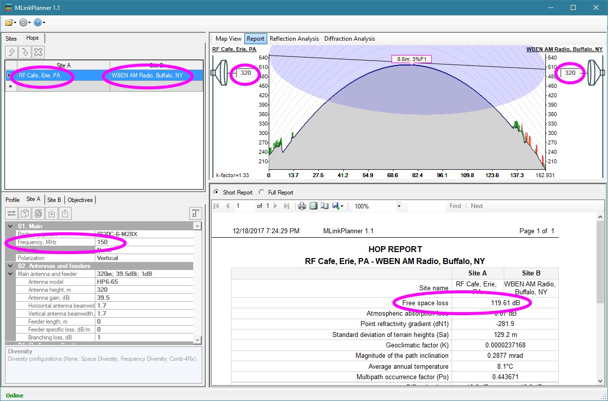
Mr. Oleg Sakharov, Director of the Center of Telecommunication Technologies, LLC, recently sent me information on the MLinkPlanner software for performing microwave communications link design. Judging only from the provided screenshots and the online documentation, MLinkPlanner looks to be very user friendly and loaded with features. I downloaded (and scanned with Norton AV) the 7-day free trial.
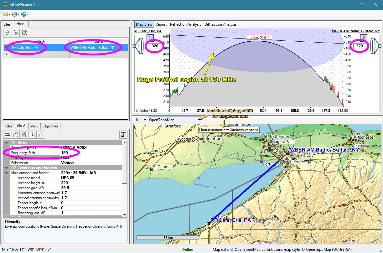
MLinkPlanner for Erie to Buffalo There are a few artifacts in the program that remind you MLinkPlanner is a foreign product, such as imperfect translation to English in some places and a few of the mouseover hints appear in Russian :-). Your trial files cannot be saved. There is a nag screen that pops up occasionally to remind you of the time remaining on the trial period. However, none of these are an impediment to your successfully testing the product for suitability. There are a lot of microwave point-to-point and point-to-multipoint planning software packages with varying degrees of ability, but good luck finding the price for most of them without contacting a sales representative. MLinkPlanner has an advertised price of $499 US for a single-user license. The following is an excerpt from the MLinkPlanner user manual:
About Center of Telecommunication Technologies, LLC Center of Telecommunication Technologies, LLC (CTT, LLC) www.ctt-group.ru Novosibirsk, Russia is the developer of the MLinkPlanner software. The company has been on the Russian market for more than 15 years, and all this time we have been actively working in two directions - the design of radio communication networks and the development of software for design. During our work, our specialists carried out projects on more than 1000 microwave hops, more than 800 base stations of mobile communication, more than 100 television and broadcasting transmitters. The geography of the work is Russia, the main customers are mobile operators MTC, Megafon, Vimpelcom, Tele 2, oil and gas production, processing and transportation companies, as well as broadcasting companies. Since its foundation, the company has been developing specialized programs that help in the design of radio communication networks: - DRRL (microwave link design); - RadioPlanner (calculation of radio coverage areas for mobile communication and broadcasting); - SanZone (calculation of biologically hazardous areas); - EMC Planner (calculation of electro-magnetic compatibility); In this software, developers are investing their entire experience in designing real-world radio networks. Being recognized experts in this field, our experts author the textbook for high schools "Basics of designing digital radio relay communication lines" https://www.techbook.ru/book.php?id_book=673 Until recently, we offered software only in the Russian market. Many design organizations, system integrators, telecom operators, TV and radio broadcasters, and government agencies in Russia and the CIS have been the licensed users of our software products. Now we are pleased to offer you the program MLinkPlanner, which was developed specifically for the global market. The program is a convenient tool for designing radio relay links with all the necessary functionality. In addition, the program has a number of unique functions for working with GIS. The MLinkPlanner capabilities will be complemented, further functionality is planned. Contact: Sakharov Oleg Director Center of Telecommunication Technologies, LLC. Russia Web: www.mlinkplanner.com
Posted December 19, 2017 |
||